
EXPAND YOUR HORIZONS
swallow vtol
The ultimate enterprise drone for your professional surveying missions.
SWALLOW VTOL
Il drone enterprise definitivo per i tuoi rilievi professionali.
WHY CHOOSE IT?
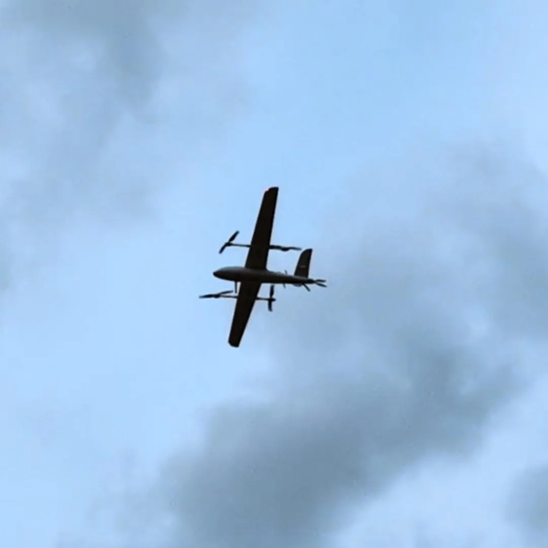
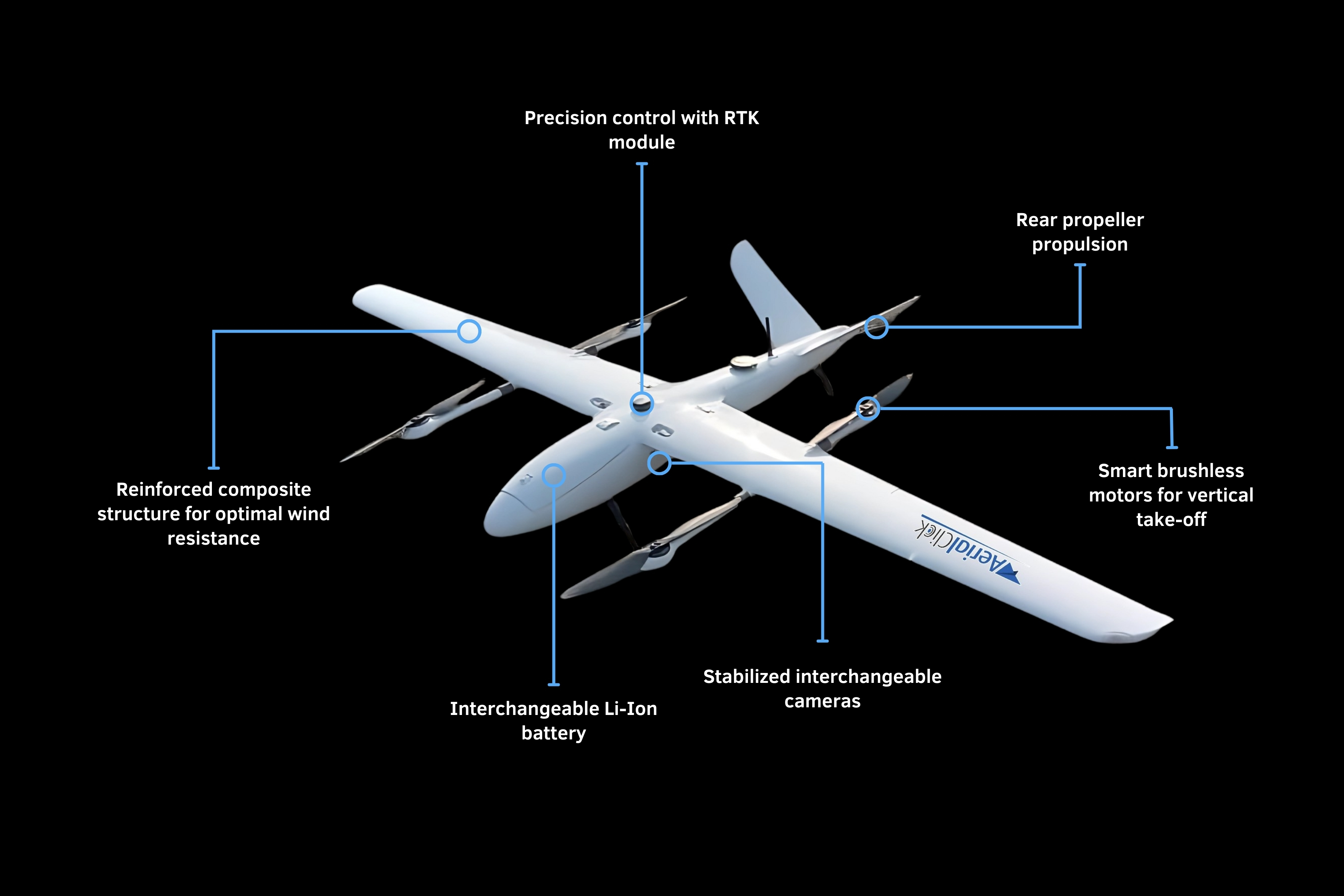
The Swallow VTOL is a professional fixed-wing drone with vertical take-off and landing, designed for high-precision operations and long endurance. Thanks to its hybrid configuration, it combines the aerodynamic performance of a fixed wing — maximizing efficiency and reducing consumption during horizontal flight — with the versatility of a multirotor, ensuring precise take-offs and landings even in confined or runway-less areas.
Built with composite materials, the system supports modular payloads for integrating photogrammetric, multispectral or LiDAR sensors, as well as RTK/PPK positioning systems for centimeter-level georeferencing.

ENDURANCE
UP TO 2 HOURS

MAX SPEED
UP TO 22 m/s

OPERATING RANGE
UP TO 10 km

CENTIMETER-LEVEL GEOREFERENCING

MODULAR
PAYLOADS

WEATHER
RESISTANCE
ADVANCED TECHNOLOGY FOR SURVEYING
PERCHé SCEGLIERLO?
Lo Swallow VTOL è un drone professionale ad ala fissa con decollo e atterraggio verticale, progettato per operazioni ad elevata precisione e lunga autonomia.
Grazie alla sua configurazione ibrida, integra le caratteristiche aerodinamiche di un'ala fissa per massimizzare l'efficienza in volo orizzontale e ridurre i consumi, con quelle di un multirotore per garantire decolli e atterraggi precisi anche in aree ristrette o prive di piste.
Realizzato in materiale composito, il sistema è dotato di payload modulari per l’integrazione di sensori fotogrammetrici, multispettrali o LiDAR, e di sistemi RTK/PPK per una georeferenziazione centimetrica.
APPLICATION FIELDS
The Swallow VTOL is the ideal choice for missions requiring precision, extensive coverage, and reliability in variable environmental conditions.
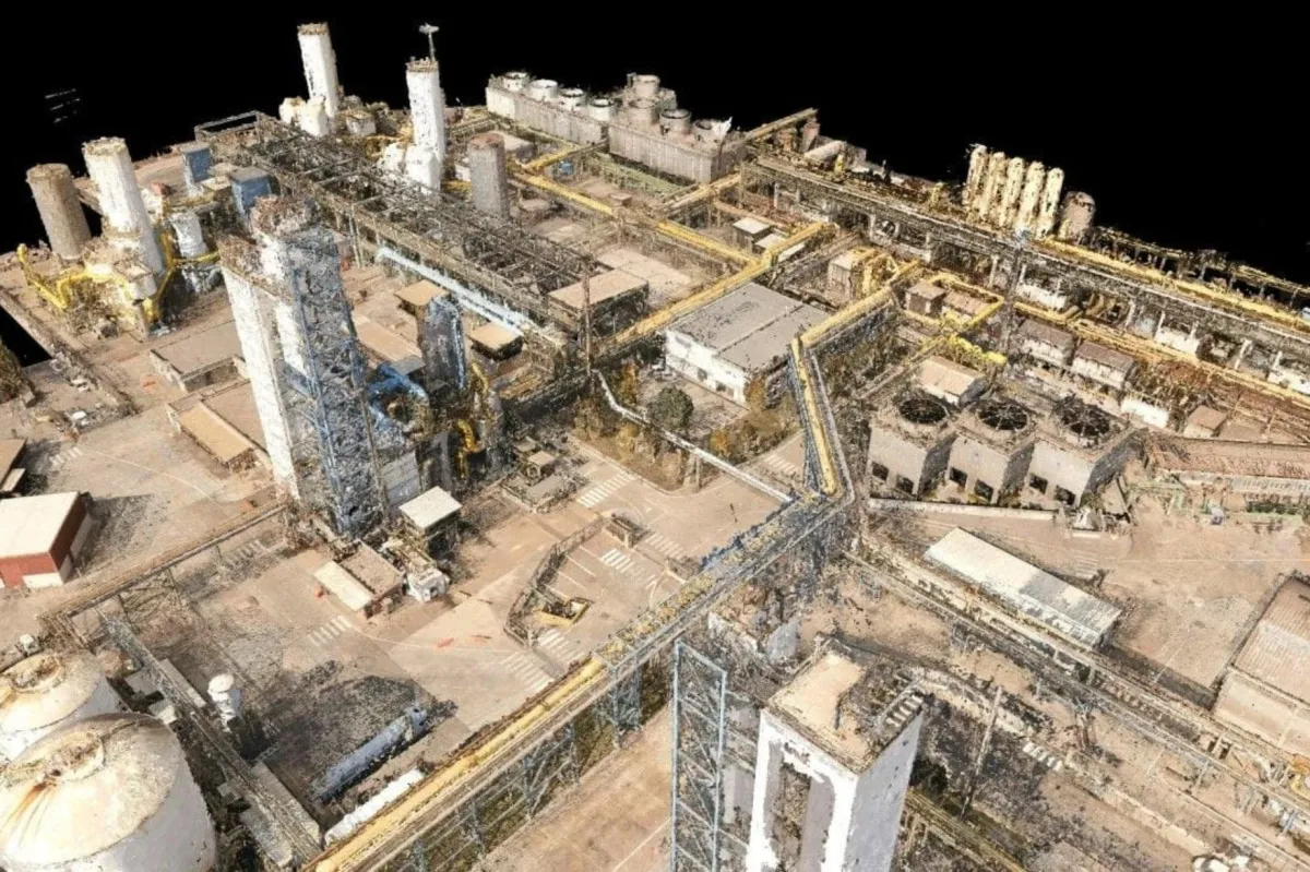
PHOTOGRAMMETRY
The Swallow VTOL is designed for high-precision topographic surveys, thanks to the integration of various types of high-resolution photogrammetric sensors and RTK/PPK positioning systems. Its ability to cover large areas in a single flight makes it ideal for producing orthophotos, digital terrain models (DTMs), and detailed GIS maps, significantly reducing time and costs compared to traditional methods.
ISPEZIONI CRITICHE
Lo Swallow VTOL è uno strumento efficace per l'ispezione di infrastrutture critiche come linee elettriche, oleodotti, ponti e impianti industriali. La sua capacità di volo stazionario combinata con l'efficienza del volo ad ala fissa consente di eseguire ispezioni dettagliate su ampie distanze, riducendo i rischi per il personale e aumentando la frequenza e la qualità delle ispezioni.
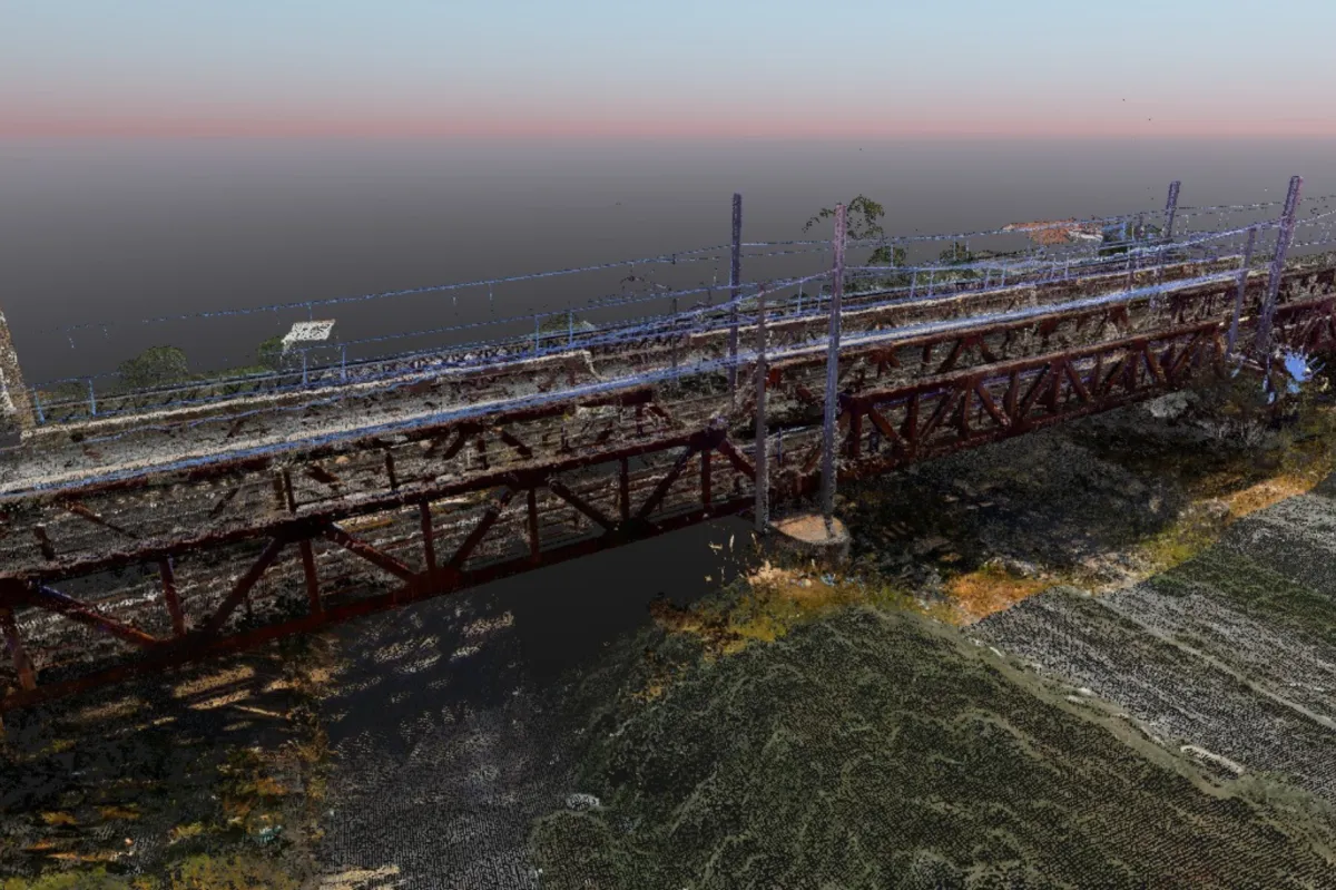
CRITICAL INSPECTIONS
The Swallow VTOL is an effective tool for inspecting critical infrastructures such as power lines, pipelines, bridges, and industrial facilities. Its ability to hover, combined with the efficiency of fixed-wing flight, enables detailed inspections over long distances, reducing risks for personnel while increasing both the frequency and the quality of inspection operations.
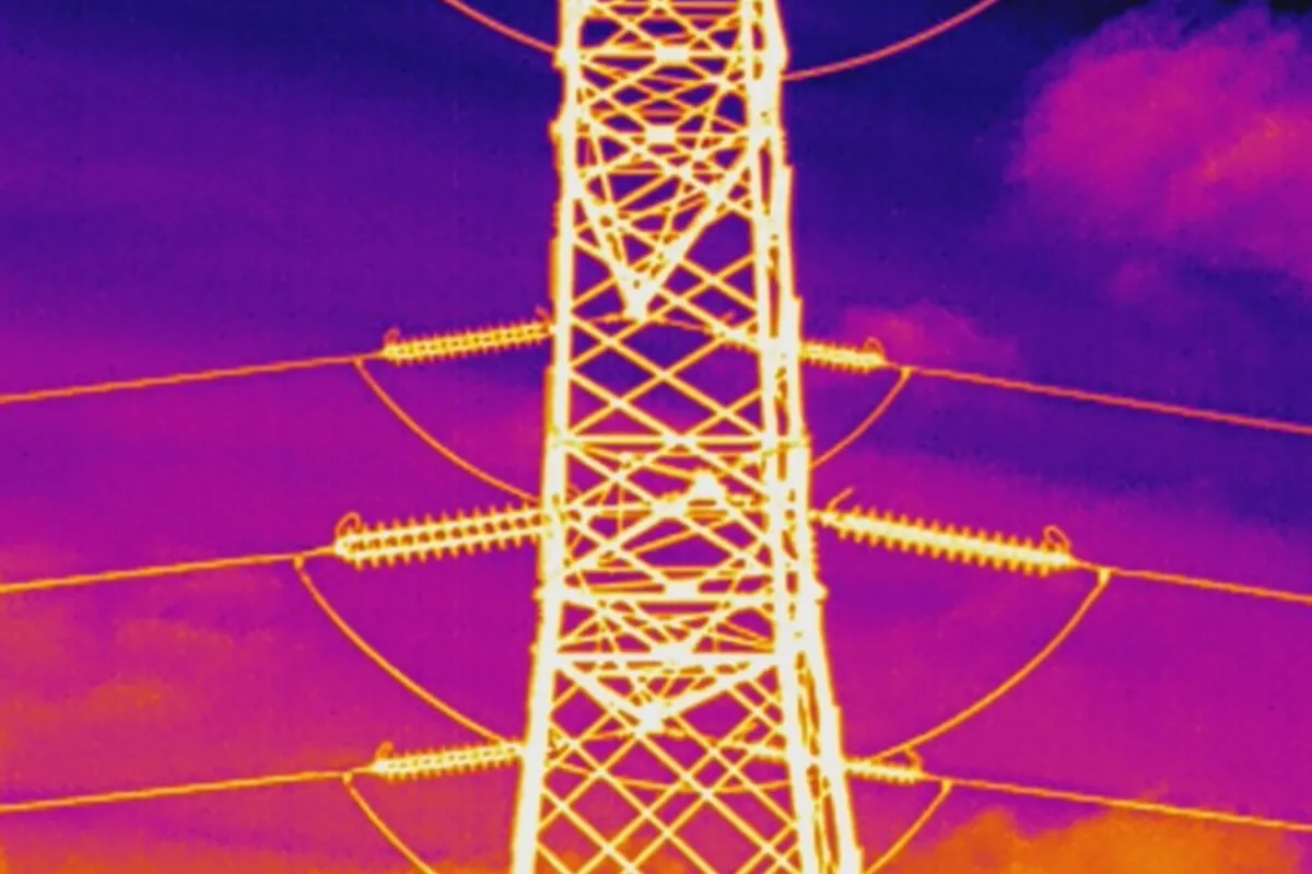
TERMOGRAPHY
The Swallow VTOL is an ideal solution for conducting thermographic inspections over large areas quickly, accurately, and cost-effectively. When equipped with high-sensitivity thermal sensors, it can detect thermal anomalies in photovoltaic plants, power lines, buildings, and industrial structures. Its ability to cover extensive areas in a single flight makes it a highly efficient tool, significantly reducing time, costs, and operational risks compared to traditional inspection methods.

EMERGENCY MANAGEMENT
In emergency situations, the Swallow VTOL can be rapidly deployed to assess damage, locate people in distress, and support rescue operations. Its ability to provide real-time data and high-resolution imagery is crucial for timely and effective response in scenarios involving natural disasters or industrial accidents.
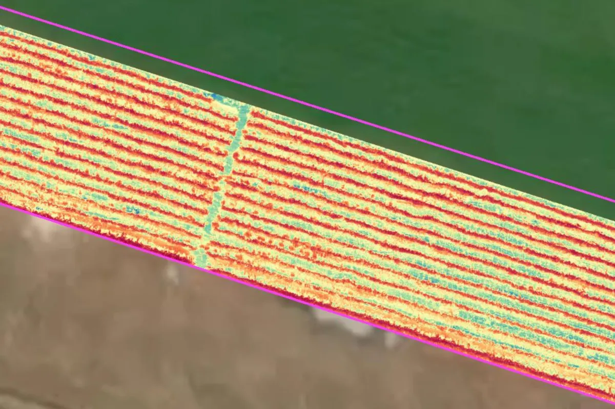
PRECISION AGRICULTURE
Thanks to the integration of multispectral sensors, the Swallow VTOL enables the acquisition of key data for calculating vegetation indices (such as NDVI and NDWI), which are essential for early detection of phytosanitary issues, water stress, and nutritional imbalances in crops. This capability for precise, georeferenced analysis allows for a more efficient use of agronomic inputs (water, fertilizers, phytosanitary products), increasing productivity while reducing environmental impact.

Copyright © 2026. Tutti i diritti riservati. Aerialclick | P. IVA: 02375580749
FOLLOW US